


6.3 magnitude earthquake strikes off the coast of Oregon
 Quick Read
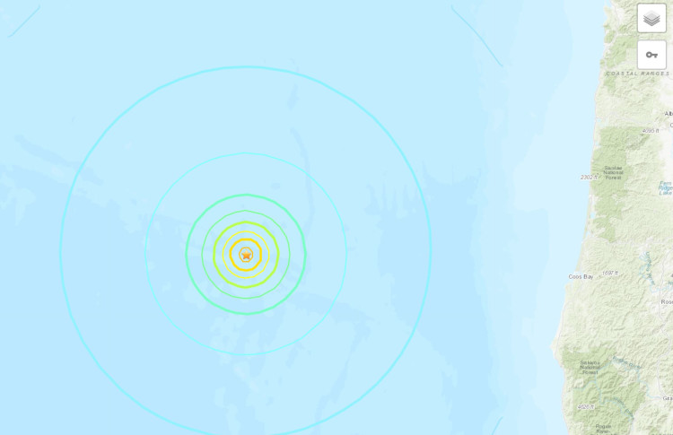
The United States Geological Survey has reported a 6.3 magnitude earthquake which struck 284 kilometres West-Northwest of Bandon, Oregon, in the United States.
The United States Geological Survey has reported a 6.3 magnitude earthquake which struck 284 kilometres West-Northwest of Bandon, Oregon, in the United States.
According to the United States Geological Survey, the M 6.3 earthquake near the coast of Oregon occurred as the result of strike-slip faulting along the Blanco Fracture Zone, a transform fault marking the boundary between the Pacific Plate to the southwest and the Juan de Fuca Plate to the northeast.
Moment tensor solutions show faulting occurred as a result of slip on a steeply dipping fault, either from left-lateral slip on a northeast striking fault or right-lateral slip on a southeast striking fault. Given the moment tensor and orientation of the fracture zone, this event occurred on a steeply dipping, right-lateral, southeast striking fault.
At this location, the Juan de Fuca Plate slides past the Pacific Plate at a rate of 49 mm a year along an azimuth of 110 degrees from north. The Juan de Fuca plate ultimately subducts beneath North America along the Cascadia subduction zone about 200 km to the east of today’s event; hence, this earthquake did not occur on the subduction zone, but rather is the result of Pacific:Juan de Fuca plate boundary interactions farther west.
Comments